
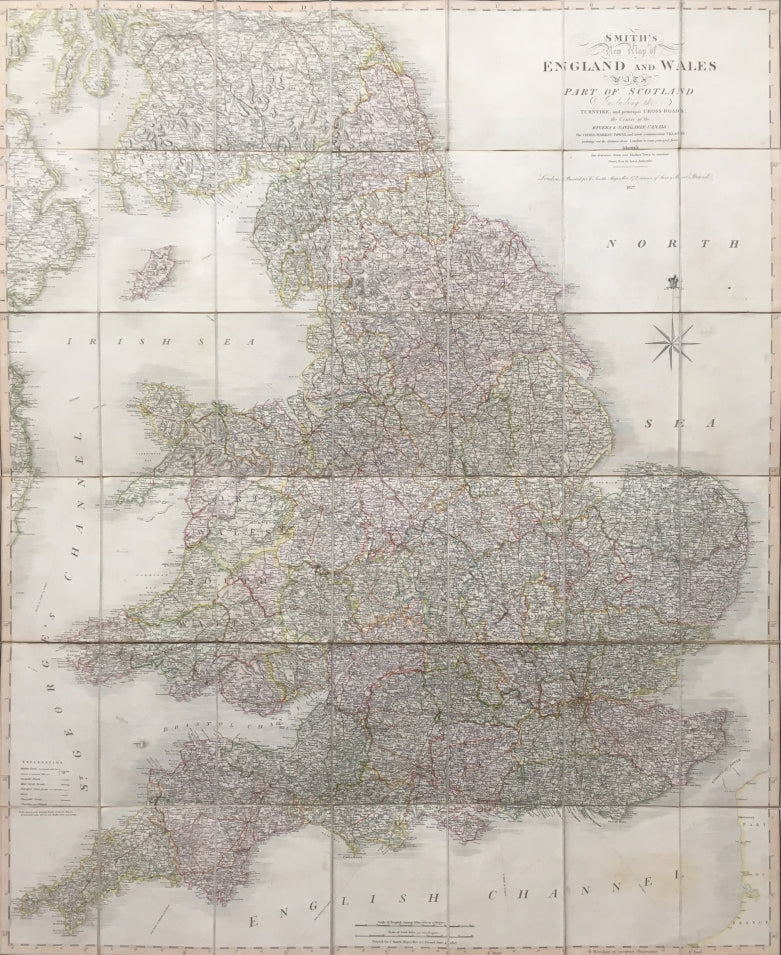
Charles Smith. "Smith's New Map of England and Wales with Part of Scotland"
London: C. Smith, 1827. Separately issued, folding map: dissected into 42 sections and mounted onto linen. 44 3/4 x 27. Engraving. Original hand color. Some slight surface smudging. Very good condition. In original paper slip case with circular label. Some wear and separations at edges of case, but generally very good.
A very large and detailed transportation map by Charles Smith, "Engraver and Map Seller Extraordinary to H.R.H. the Prince of Wales." The focus of this map is best explained by the subtitle: "Including the Turnpike, and principal Cross Roads. the Course of the Rivers & Navigable Canals; The Cities, Market Towns, and most considerable Villages: pointing out the distances from London to every principal Town: likewise the distance from one Market Town to another."

 %20%0A%20%0Ahttps://philaprintshop.com/products/smith-charles-smiths-new-map-of-england-and-wales-with-part-of-scotland %20%0A%20%0ASmith,%20Charles%20%22Smith's%20New%20Map%20of%20England%20and%20Wales%20with%20Part%20of%20Scotland%22 %20%0A%20%0A//philaprintshop.com/cdn/shop/products/smithengland_1024x1024.jpg?v=1614235086 %20%0A%20%0AAntique Prints, Maps, Drawings, Paintings and Rare Books! %20%0A%20%0AThe Philadelphia Print Shop %20%0A106 E. Lancaster Avenue, Lower Level %20%0AWayne, PA 19087 %20%0A%20%0APhilaPrintShop.com %20%0A@PhiladelphiaPrintShop %20%0A 610 (808) 6165)