![Wilkinson, James [Atlas intended to accompany] "Memoirs of My Own Times. By General James Wilkinson"](http://philaprintshop.com/cdn/shop/products/wilkinsoncover_{width}x.jpg?v=1652992723)
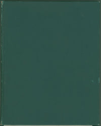
James Wilkinson. [Atlas intended to accompany] Memoirs of My Own Times. By General James Wilkinson.
Philadelphia: Abraham Small, 1816. Atlas only. 19 maps and plans numbered 20 of various sizes. Sheets uncut but some patched. Ex libris, small ink stamps on 2 sheets. Bound in attractive cloth. Repairs to maps excellent.
A superb copy of this very scarce atlas which Howes speculates was issued separately since the text and atlas are seldom found together. Despite the missing parts of Gen. Ross’s route map, this atlas would serve well to accompany a set of the three volume text.
The maps by Henry S. Tanner are unusual and listed here with titles and sizes (by neatlines--all have full margins). Title page and “advertisement” with stains and small library ink stamps.
- “Sketch of the Rivers St. Lawrence and Soriel...” 4 1/2 x 7 1/2.
- “Sketch of Trenton . . . Dec. 26th 1776.” 4 1/4 x 8.
- “Part of New Jersey embracing Trenton and Princeton . . .” 13 1/4 x 13 1/4.
- “Affair of Princeton . . . 1777.” 8 1/4 x 6 1/8.
- “Part of the River St. Lawrence.” 4 1/4 x 7 1/2.
- “Sketch of the St. Lawrence from Cornwall to Grand River...” 4 1/2 x 6 1/4.
- “...American Troops on the 30th March 1814 before La Colle Mill...” [near Sorrel River]. 4 3/8 x 7 1/2.
- “Sackets Harbor.” 4 1/4 x 9.
- “Niagara River.” 6 x 4 1/4.
- “Battle of Bridgewater. View 1st.” 10 x 6 1/2.
- “Battle of Bridgewater. View 2nd.” 10 x 6 1/2.
- “Battle of Bridgewater. View 3rd.” 10 x 6 1/2.
- “Battle of Bridgewater. View 4th.” 10 x 6 1/2.
- “Map of the Straights of Niagara...” 15 x 7.
- “Map of Maj: Gen: Ross’s route, with the British Column, from Benedict on the Patuxent River, to the city of Washington, August 1814.” 13 3/4 x 15 1/4. [bottom margin cut off and l.r. corner 6” x 4” missing = 3/4th of map]
- “The Affair of Bladensburg [Maryland] August 21st. 1814.” 6 x 7.
- “Philadelphia.” Battles at Germantown and Barren Hill. 6 x 4 1/4.
- “Plan of Rouses Point . . . Lake Champlain.” 7 1/2 x 4 1/4.
- “Part of Vermont.” 7 1/2 x 4 1/2.

![Wilkinson, James [Atlas intended to accompany] "Memoirs of My Own Times. By General James Wilkinson"](http://philaprintshop.com/cdn/shop/products/wilkinsontitlepage_{width}x.jpg?v=1652992722)
![Wilkinson, James [Atlas intended to accompany] "Memoirs of My Own Times. By General James Wilkinson"](http://philaprintshop.com/cdn/shop/products/wilkinsonmajgenross_{width}x.jpg?v=1652992722)
![Wilkinson, James [Atlas intended to accompany] "Memoirs of My Own Times. By General James Wilkinson"](http://philaprintshop.com/cdn/shop/products/wilkinsonpl123_{width}x.jpg?v=1652992722)
![Wilkinson, James [Atlas intended to accompany] "Memoirs of My Own Times. By General James Wilkinson"](http://philaprintshop.com/cdn/shop/products/wilkinsonspine_{width}x.jpg?v=1652992722)
![Load image into Gallery viewer, Wilkinson, James [Atlas intended to accompany] "Memoirs of My Own Times. By General James Wilkinson"](http://philaprintshop.com/cdn/shop/products/wilkinsoncover_110x110@2x.jpg?v=1652992723)
![Load image into Gallery viewer, Wilkinson, James [Atlas intended to accompany] "Memoirs of My Own Times. By General James Wilkinson"](http://philaprintshop.com/cdn/shop/products/wilkinsontitlepage_110x110@2x.jpg?v=1652992722)
![Load image into Gallery viewer, Wilkinson, James [Atlas intended to accompany] "Memoirs of My Own Times. By General James Wilkinson"](http://philaprintshop.com/cdn/shop/products/wilkinsonmajgenross_110x110@2x.jpg?v=1652992722)
![Load image into Gallery viewer, Wilkinson, James [Atlas intended to accompany] "Memoirs of My Own Times. By General James Wilkinson"](http://philaprintshop.com/cdn/shop/products/wilkinsonpl123_110x110@2x.jpg?v=1652992722)
![Load image into Gallery viewer, Wilkinson, James [Atlas intended to accompany] "Memoirs of My Own Times. By General James Wilkinson"](http://philaprintshop.com/cdn/shop/products/wilkinsonspine_110x110@2x.jpg?v=1652992722)
