

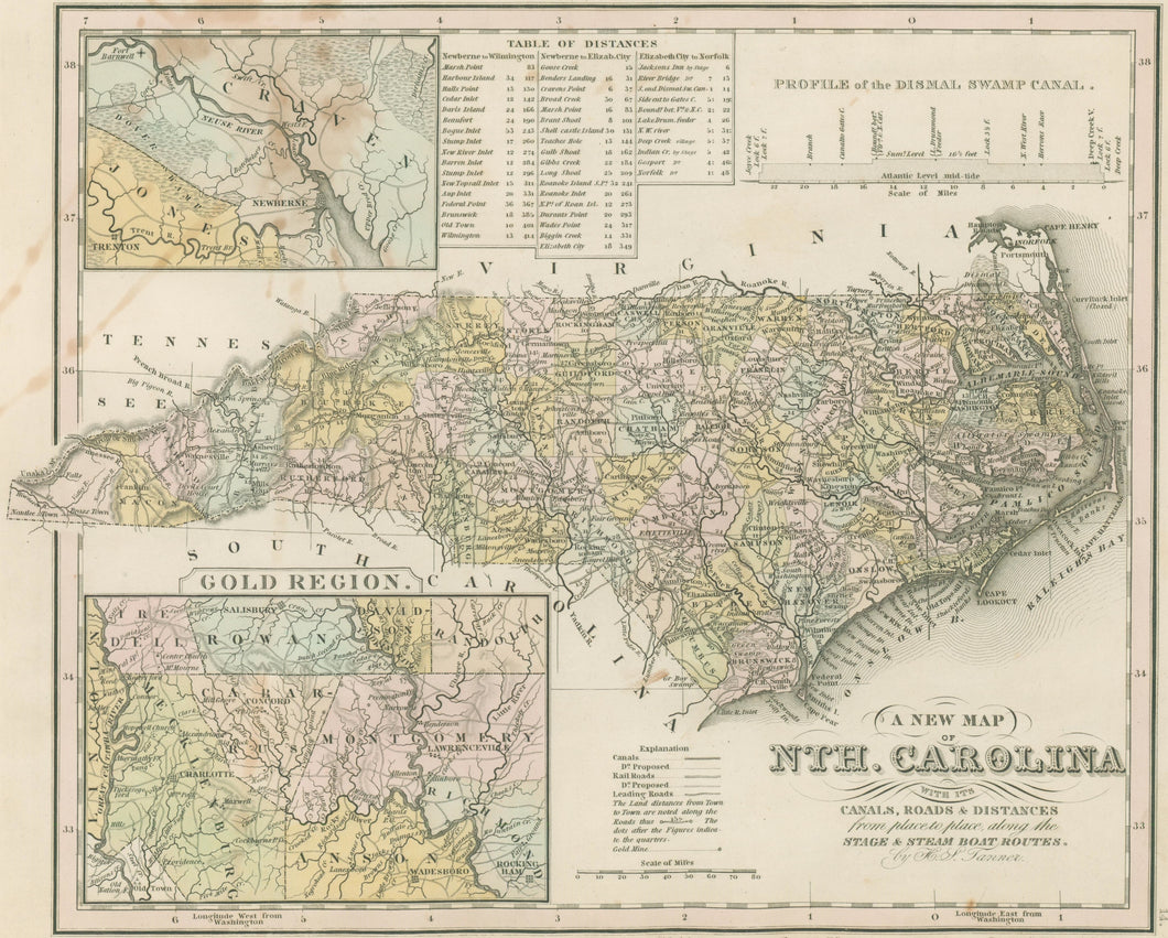

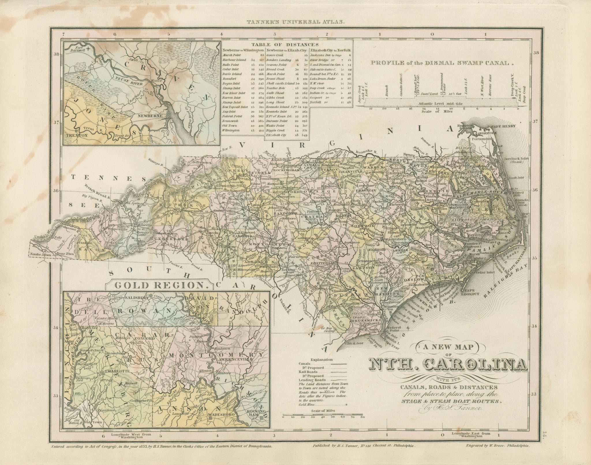
Henry S. Tanner. “North Carolina.”
From Tanner's Universal Atlas. Philadelphia: H. S. Tanner, 1833. 10 1/2 x 13 3/8. Engraved by W. Brose. Original hand color. Some fading to original hand color. Large stain in upper left hand portion of map and margins. Fair condition and sold as is.
A superior and detailed map by the great American cartographer, Henry Schenck Tanner. In 1816, Henry, his brother Benjamin, John Vallance and Francis Kearny formed an engraving firm in Philadelphia. Having had experience at map engraving through his work with John Melish, Tanner conceived of the idea of compiling and publishing an American Atlas, which was begun in 1819 by Tanner, Vallance, Kearny & Co.. Soon Tanner took over the project on his own, and thus began his career as cartographic publisher. The American Atlas was a huge success, and this inspired Tanner to produce his Universal Atlas, of more manageable size. This atlas contained excellent maps of each state, focusing on the transportation network, including roads, railroads and canals. All details are clearly presented, and these include towns, rivers, mountains, political boundaries and the transportation information. The maps were later purchased by S. Augustus Mitchell, and then Thomas, Cowperthwait & Co., but it is these early Tanner editions which are the rarest and most important.
 %20%0A%20%0Ahttps://philaprintshop.com/products/tanner-henry-s-north-carolina %20%0A%20%0ATanner,%20Henry%20S.%20%20%E2%80%9CNorth%20Carolina%E2%80%9D %20%0A%20%0A//philaprintshop.com/cdn/shop/files/tannerncthmb_1024x1024.jpg?v=1708796457 %20%0A%20%0AAntique Prints, Maps, Drawings, Paintings and Rare Books! %20%0A%20%0AThe Philadelphia Print Shop %20%0A106 E. Lancaster Avenue, Lower Level %20%0AWayne, PA 19087 %20%0A%20%0APhilaPrintShop.com %20%0A@PhiladelphiaPrintShop %20%0A 610 (808) 6165)