


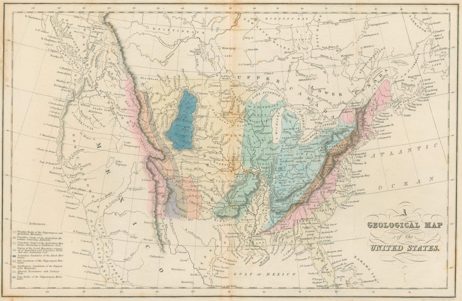
John H. Hinton. “A Geological Map of the United States.”
London: I.T. Hinton & Simpkin & Marshall, 1832. 9 3/4 x 15 1/4. Engraving by Fenner, Sears & Co. Original hand color. Some discoloration along centerfold. Else, very good condition.
An early geological map of the United States issued in England in 1832. Nine different types of geological regions are identified for the region east of the continental divide, indicated with bright hand colored explained in a key in the lower left. This geological information is layered on a geographical picture that is, in what is now the American West, very confused. The Rockies are shown as a single ridge, with seemingly a simple passage from the east across to rivers running straight to the Pacific Ocean; this was an error long held by many about the region. A number of “rivers of the west” are indicated, including the famous "Rio San Buenaventura.” Attractive and fascinating for its depiction of the state of knowledge of the continent at the time.

 %20%0A%20%0Ahttps://philaprintshop.com/products/hinton-john-h-a-geological-map-of-the-united-states-from-john-h-hinton-s-the-history-and-topography-of-the-united-states-of-america %20%0A%20%0AHinton,%20John%20H.%20%20%E2%80%9CA%20Geological%20Map%20of%20the%20United%20States%22%20From%20John%20H.%20Hinton%E2%80%99s%20%22The%20History%20and%20Topography%20of%20the%20United%20States%20of%20America%22 %20%0A%20%0A//philaprintshop.com/cdn/shop/files/hintongeousc_1024x1024.jpg?v=1701812614 %20%0A%20%0AAntique Prints, Maps, Drawings, Paintings and Rare Books! %20%0A%20%0AThe Philadelphia Print Shop %20%0A106 E. Lancaster Avenue, Lower Level %20%0AWayne, PA 19087 %20%0A%20%0APhilaPrintShop.com %20%0A@PhiladelphiaPrintShop %20%0A 610 (808) 6165)